GoMaps Canberra: The Map That Does More
Shared with us by Pedal Power member Ross Franklin
Ross has shared with us an excellent new tool for navigating around Canberra, GoMaps. This article explores how he has been using it and, hopefully, provides you with some new tips and tricks for your next ride. You may even find new vistas you have never seen before!
Exploring Canberra with GoMaps

GoMaps Canberra is more than just a topographic map; it’s a complete outdoor companion designed for walkers, cyclists, horse riders, and explorers of all kinds. Created by local outdoors enthusiast Maurice Ongania, the map combines precise detail with practical usability, helping you navigate the city and its natural surrounds with confidence.
Navigation & Detail
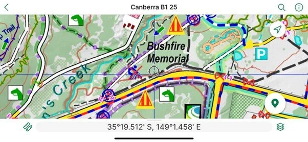
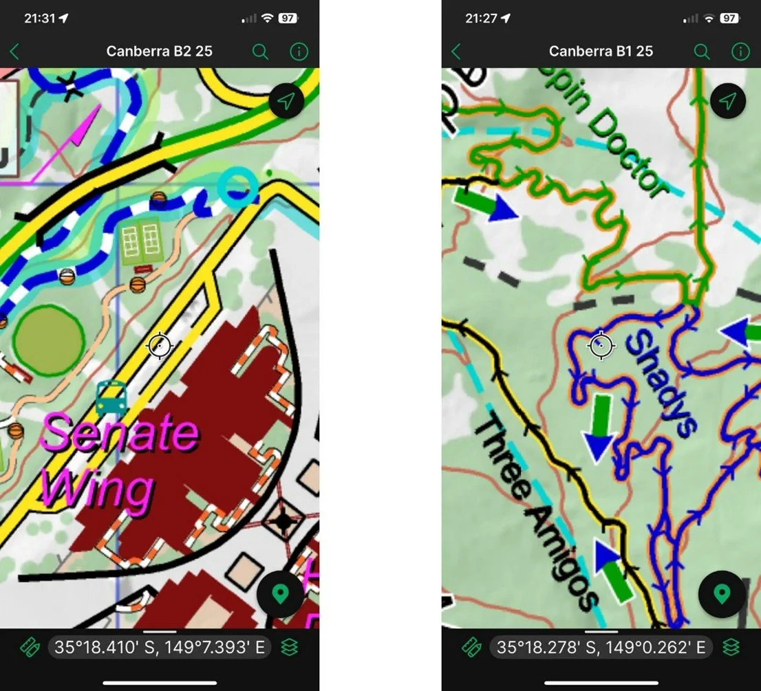
Attention to detail elevates GoMaps above standard maps. With 10-metre contours and shaded relief, users can easily interpret terrain and landforms. The high-resolution design ensures perfect clarity, even at the closest zoom levels. Covering almost 2,000 km² across Canberra, Queanbeyan, and surrounding regions, the map is divided into 12 overlapping tiles that flow seamlessly into one another.

Trails & Outdoor Activities

GoMaps provides one of the most comprehensive representations of outdoor activity networks in the region:
Cycling: All single-track mountain bike and downhill trails, including their direction of travel, plus on-road cycle lanes where legibility allows. Popular locations such as Stromlo, Majura, Bruce, and Isaacs Ridge are fully detailed.

Walking & Hiking: Major itineraries like the Canberra Centenary Trail, sections of the National Bicentenary Trail, and well-known walks such as Booroomba Rocks, Gibraltar Peak, and Mt Ainslie Summit. Local favourites like the Frost Hollow to Forest Walk and Shepherds Lookout are also included.
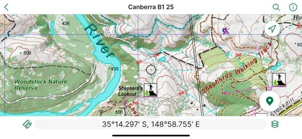
Equestrian Trails: Horse riding routes, complete with marked cavaletti gates, extend the map’s use beyond cycling and walking communities.

Points of Interest
Exploration is about more than just trails. GoMaps enriches every outing by pinpointing key features and amenities:
Cafés and picnic spots
Toilets, drinking fountains, and bathing areas
Bike repair points
Historic sites, churches, and sculptures
Monumental trees, bushland, boulders, and rock slabs
This attention to detail helps users not only plan their routes but also discover new highlights across the capital.
Digital Integration
GoMaps is available digitally through the Avenza Maps app, allowing offline use with your smartphone’s built-in GPS. Your position is shown in real time as a blue dot, ensuring accuracy even without mobile reception. As you move, the bundle version automatically pages between tiles, keeping navigation smooth and intuitive.
For those who prefer traditional use, single tiles can also be purchased individually.
Discover More
To explore the full set of legends, trails, and examples, visit: GoMaps Legends and Features.
The Canberra GoMaps digital edition is available via Avenza: Download GoMaps Canberra.